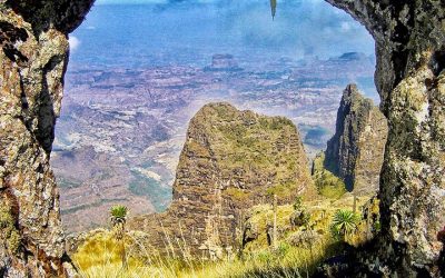
Bale Mountains

The Bale Mountains were formed prior to the creation of the Rift Valley, from lava outpourings, which covered all underlying rock formations between 38 and 7 million years ago. The rocks of the volcanic outpourings are predominantly trachytes, but also include rhyolites, basalts and agglomerates, and tuffs. The Bale highlands area consists of a vast lava plateau with at least six volcanic cones, each more than 4,200m. These cones have been considerably flattened by repeated glaciations.
There have been at least two glacial periods in the history of the mountains. These specific mountains were glaciated as little as 2,000 years ago. During the last ice age, the Bale Mountains were one of the most extensively glaciated areas in Ethiopia, with a total of approximately 180km2 of ice. There was a 30km2 ice cap around the peak of Tulu Dimtu on the Sanetti plateau and individual glaciers of considerable thickness reached down to 3,200m. As a consequence, the landscape as we see it today is the lava outpourings modified by over 20 million years of erosion by water, wind and ice.
There are certain geological features that remain an enigma to geologists and glaciologists, such as the striations (or boulder grooves) that appear on shallow hillsides on the Sanetti plateau. Boulder grooves, till ridges and numerous glacial valleys, such as the Togona Valley on the northeastern slopes of the Sanetti plateau, provide evidence of the ice age effects on the landscape of the Bale Mountains National Park. Until the beginning of de-glaciation (13,000 to 14,000 years ago), the snowline was at 3,700m and the upper tree limit in the Bale Mountains was well below 3,000m. Fluctuations in climate over the last historical period, including the last 3,000 years, have dramatically affected vegetation and other biodiversity in the highlands.
Related Attractions
Simien Mountains
Ethiopia is home to 80% of the land in Africa above 3,000m. Thus, the Simien Mountains, with the highest point in Ethiopia (Ras Dejen at 4,543m) is also known as ‘the roof of Africa.’ The Simien Mountains were formed prior to the creation of the Rift Valley, from lava...
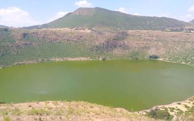
The Debreziet (Bishoftu) Crater Lakes
The craters are maars, or explosion craters, similar to El Sod, and were formed in a similar manner by a multitude of explosive steam eruptions through groundwater or a shallow lake. The crater rim deposits at DebreZeit (Bishoftu) consist of cinders, ash, and...
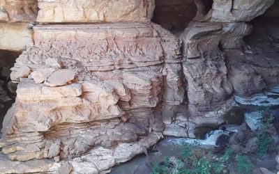
Sof Omar Caves
Sof Omar Cave- "unique harmony between nature and culture"The Sof Omar Cave System, a spectacular and extensive cave system in southeastern Ethiopia represents a maze of dry cave passages, which subsequently were crossed by a subterranean watercourse formed by the...
Lake Afdera
Lake Afdera [Lake Afrera], located in the Afar region, Ethiopia. It is a supper saturated saline Lake located in the Danakil Depression, lying below a sea level with the lowest point at –112m and has a surface area of 140km2. It is a major source of salt extraction in...
Ethiopian Rift Valley
The great Rift Valley of Ethiopia is not only the cradle of humankind, but also the place on Earth where humans have lived with volcanoes, and exploited their resources, for the longest period of time. Perhaps as long ago as 3 Million years, early hominids began to...
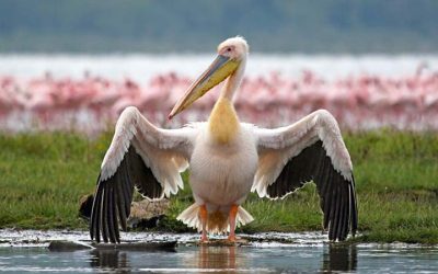
Lake Abaya & Chamo
The two lakes themselves are separated by a ridge of basalt known as Tosa Sucha, or the “Bridge of God”,which formed between 1.34 and 0.68 million years ago. Currently, the only connection between the lakes is a small channel which flows only when their water levels...
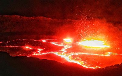
Erta’ale Volcanoes
Geology Erta Ale is 613 meters (2,011 ft) high, with one or sometimes two active lava lakes at the summit which occasionally overflow on the south side of the volcano. It is notable for holding the longest-existing lava lake, present since the early years of the...
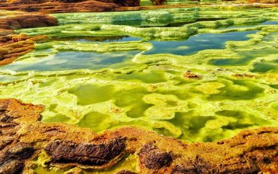
Danakil Depression
The Danakil Depression lies at the triple junction of three tectonic plates and has a complex geological history. It has developed as a result of Africa and Asia moving apart, causing rifting and volcanic activity. Erosion, inundation by the sea, the rising and...
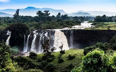
Blue Nile River
The Blue Nile originates at Lake Tana in Ethiopia (where it is called the Abay River). The river flows generally south before entering a canyon about 400 km (250 mi) long, about 30 km (19 mi) from Lake Tana, which is a tremendous obstacle for travel and communication...